
Confirming that your land use is permitted is the easy part of site due diligence. The expensive part comes next.
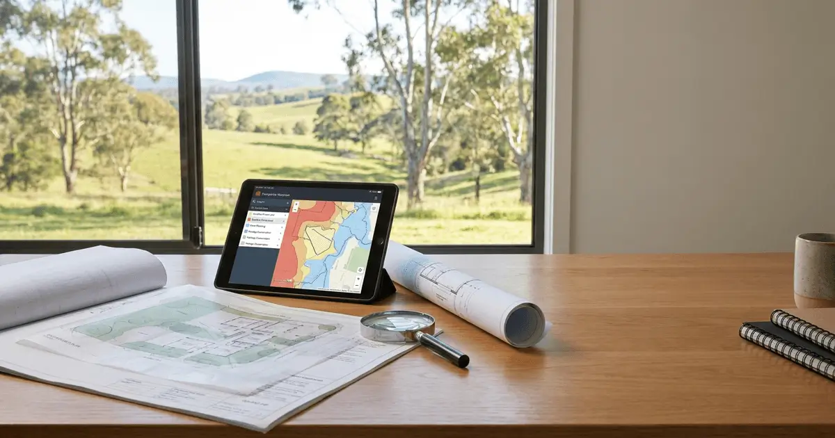
A parcel can sit in an R2 zone, satisfy its floor space ratio and height limit, and still be commercially unworkable. Three overlays on the NSW Planning Portal Spatial Viewer decide whether a project proceeds, what it costs to build, and whether it can be approved in weeks or must run the gauntlet of a full council assessment. They are bushfire, flood and heritage — the constraint triangle. Reading the bushfire and flood planning maps in NSW properly, before you commit to a site, is the difference between a feasibility model that holds and one that collapses at tender.
If you have not established your property's zone, start with our guide on how to check zoning in NSW. For the platform itself, see the ePlanning Spatial Viewer Guide.
Key Takeaways
- An overlay is a trigger, not a prohibition: Being mapped as bush fire prone or flood affected changes what you must build and how you must prove it.
- Vegetation categories are not BAL ratings: Buffers are 100 metres for Category 1 and 30 metres for Categories 2 and 3. BAL is a separate calculation under AS 3959:2018.
- High BAL ratings close the fast track: A BAL Certificate can support a CDC at BAL-29 or lower; BAL-40 or BAL-FZ forces a council Development Application.
- Freeboard is not a statewide 500mm rule: The Flood Planning Level is the Defined Flood Event plus the freeboard selected for that catchment — commonly 300–500mm, but read it from council flood information.
- The flood manual changed in 2023: The NSW Flood Risk Management Manual replaced the 2005 Floodplain Development Manual.
- Heritage is the most complete CDC disqualifier: An HCA applies to every property inside it, whether or not your dwelling is individually listed.
Layer 1: Bush Fire Prone Land — Reading the Map
The Bush Fire Prone Land map is prepared under the Guide for Bush Fire Prone Land Mapping and certified by the Commissioner of the NSW Rural Fire Service. It shows vegetation categories, each with a buffer:
| Map element | What it covers | Buffer |
|---|---|---|
| Vegetation Category 1 | Forest, woodlands, heaths (tall and short), forested wetlands and timber plantations — highest risk | 100 m |
| Vegetation Category 2 | Rainforests, remnant vegetation and land under management practices that actively reduce bush fire risk — lower risk | 30 m |
| Vegetation Category 3 | Grasslands, freshwater wetlands, semi-arid woodlands, alpine complex and arid shrublands | 30 m |
Two misunderstandings cause most of the confusion. The buffer is a mapping convention, not a safety clearance — being 95 metres from Category 1 forest means a BAL assessment is required, not that the building must be constructed a particular way. And the vegetation category is not the BAL: the map tells you an assessment is needed; the BAL is the output.
The BAL Scale and What Each Level Costs to Build
The Bushfire Attack Level (BAL) quantifies potential bushfire exposure as radiant heat flux in kilowatts per square metre, determined under Australian Standard AS 3959:2018, with construction requirements flowing from Planning for Bush Fire Protection 2019.
| BAL | Radiant heat flux | Predicted bushfire attack |
|---|---|---|
| BAL-LOW | Insignificant | Risk too low to warrant specific construction requirements, though ember attack may still occur |
| BAL-12.5 | ≤ 12.5 kW/m² | Primarily ember attack; radiant heat considered low |
| BAL-19 | 12.5 – 19 kW/m² | Moderate risk, particularly from embers and burning debris |
| BAL-29 | 19 – 29 kW/m² | High risk from embers, debris and heat |
| BAL-40 | 29 – 40 kW/m² | Very high risk; embers, debris, heat and potential intermittent flame contact |
| BAL-FZ | ≥ 40 kW/m² | Extreme risk; direct exposure to flames from the fire front |
BAL-12.5 adds tempered or toughened glass, ember-proof mesh on vents, weep holes and roof spaces, non-combustible gutters, and sealed roof-to-wall junctions. BAL-19 escalates the specification: window frames must be metal or fire-resistant timber rather than standard uPVC, external walls must be non-combustible or bushfire-resisting, and decking must be fire-resistant — the material list your quote was priced against no longer applies.
BAL-29 and above requires fire-rated or shuttered windows, non-combustible external surfaces, sarked roofs with ember-proof mesh, and no standard timber decking. BAL-40 means a different building: fire-rated windows to specified resistance levels, external surfaces restricted to concrete, steel, brick and fibre cement, a reinforced roof structure, constrained window-to-wall ratios, and sprinklers in many cases. BAL-FZ requires full fire-rated construction, fire-rated glazing only, a concrete-and-steel-dominant structure and a dedicated firefighting water supply.
The feasibility consequence is blunt: the gap between a BAL-19 and a BAL-40 build can exceed the gap between a standard and an architecturally specified build.
BAL also decides which approval pathway survives. At BAL-29 or lower, a BAL Certificate can support a Complying Development Certificate; at BAL-40 or BAL-FZ that pathway closes and the project requires a Development Application with a full Bushfire Assessment Report. Where the proposal is integrated development, a Bush Fire Safety Authority under section 100B of the Rural Fires Act 1997 is required.
Layer 2: Flood Planning Areas and Floor Levels
The flood layer shows the Flood Planning Area — land below the Flood Planning Level, and therefore subject to flood-related development controls.
A regulatory change worth knowing about. Much material still circulating references the Floodplain Development Manual (April 2005). It has been superseded by the NSW Flood Risk Management Manual (gazetted June 2023), effective 10 November 2023, when the EP&A Regulation 2021 and Standard Instrument LEP were amended. The amendments also changed clause 5.22, so a consent authority must now consider rather than be satisfied about the listed matters for sensitive and hazardous development.
Three terms matter. The Defined Flood Event (DFE) is the flood event selected as the general standard — the 1% AEP event (the 1-in-100-year flood) is typical, but not universal. The Flood Planning Level (FPL) is the DFE flood level plus freeboard. The Probable Maximum Flood (PMF) is the extreme event, and land between the Flood Planning Area and the PMF remains subject to flood-related controls. Your section 10.7 planning certificate must now disclose both.
The freeboard correction. The most repeated error in NSW flood guidance is that freeboard is 500mm statewide. It is not. Freeboard is a factor of safety selected for the particular catchment and flood type; many councils apply 300–500mm for mainstream flooding, but overland flow precincts can differ.
Finished floor levels and their cascading costs. Habitable floors must be set at or above the Flood Planning Level. That drives site works: imported fill with compaction certification or a switch to pier and suspended slab; driveway grades that may exceed maximum gradient controls on small or steep lots; steps, ramps and retaining walls; and adjusted sewer, water and stormwater connections. Non-habitable floors are generally permitted below the FPL under strict conditions requiring flood-compatible construction. Complying development is available on a flood control lot only where the Codes SEPP's flood-related standards are met, addressing floor levels, flood storage and, for sensitive uses, evacuation criteria.
Layer 3: Heritage — Items and Conservation Areas
Heritage in NSW runs on two parallel systems. State heritage items sit on the State Heritage Register under Part 3A of the Heritage Act 1977, and works generally require section 60 approval from the Heritage Council of NSW unless an exemption applies under section 57(2). A section 60 application is frequently integrated development, determined alongside the DA. Local heritage — items in the council's LEP heritage schedule, and land within a Heritage Conservation Area — is controlled through clause 5.10 of the Standard Instrument LEP and assessed by council in an ordinary DA. The overwhelming majority of heritage-affected homes fall into this category.
Clause 5.10(2) requires development consent for a broad range of works — demolition, alterations, new construction and subdivision — affecting a heritage item, a heritage conservation area, or land in the vicinity of one. That last element is broader than most owners expect: a neighbouring project can itself require consent where it affects the heritage streetscape. Clause 5.10(4) requires the consent authority to consider the effect on heritage significance, which is what makes a Heritage Impact Statement necessary. Clause 5.10(3) exempts genuinely minor works where council is satisfied there is no adverse effect — a narrow carve-out. Repainting in an existing colour is generally acceptable; replacing timber windows with aluminium double-hung is not.
The HCA trap. The costliest misconception is that living in a conservation area only matters if your own house is listed. An HCA applies to every property inside its boundary, whether or not the individual dwelling is identified as a heritage item.
Why heritage disqualifies fast-track approval. Heritage items and draft heritage items are excluded from the complying development pathway, and land within a heritage conservation area is excluded under several of the Codes SEPP housing codes. A standard rear extension that would be exempt or complying development on an ordinary suburban lot therefore requires a full Development Application with a Heritage Impact Statement — plus referral to a council heritage officer, which adds time beyond the standard determination period.
Where the Three Layers Intersect
These overlays rarely arrive alone. A site on a vegetated ridge inside a conservation area on a flood-affected lot carries all three, and the costs compound rather than simply add. The bushfire rating dictates materials and may force a DA at BAL-40; the flood controls dictate floor level, which dictates site works and landscaping budget; the heritage control dictates the approval pathway, and may rule out CDC entirely.
The sequence that works is: read the overlays on the Spatial Viewer, order a section 10.7 planning certificate, commission a BAL assessment and obtain the council's site-specific flood information, and confirm heritage status against both the State Heritage Register and the LEP heritage schedule — all before exchanging contracts.
Our Complying Development Eligibility Guide collects the overlay exclusions in one place, and our guide to Floor Space Ratio, Height and Minimum Lot Size in NSW covers the built-form standards alongside them.
Frequently Asked Questions (FAQ)
Does being on the bush fire prone land map mean I cannot build on my property?
No. Bush fire prone land mapping is hazard identification, not prohibition. It triggers a Bush Fire Attack Level assessment and, depending on the outcome, specific construction requirements under AS 3959:2018 and Planning for Bush Fire Protection 2019. What changes is the construction specification and, at BAL-40 or BAL-FZ, the approval pathway.
What is the difference between Vegetation Category 1 and Category 2 on the bushfire prone land map?
Category 1 is the higher-risk category — forest, woodlands, heaths, forested wetlands and timber plantations — with a 100 metre buffer. Category 2 is lower risk: rainforests, remnant vegetation and land under management practices that actively reduce bush fire risk, with a 30 metre buffer. Category 3 covers grasslands, freshwater wetlands, semi-arid woodlands, alpine complex and arid shrublands, also with a 30 metre buffer. None of these is the same thing as a BAL rating.
Is freeboard always 500mm for flood planning in NSW?
No — this is one of the most widely repeated inaccuracies in NSW flood planning. Freeboard is a factor of safety selected for the particular catchment and flood type. Many councils apply 300–500mm for mainstream flooding, but overland flow precincts can differ. Read the Flood Planning Level from the specific council's flood study.
My house is not heritage listed, but it sits in a heritage conservation area. Do I still need approval?
Yes. Clause 5.10(2) applies to development on land within a heritage conservation area whether or not the specific property is separately identified as a heritage item. Council will assess how your proposal affects the area's character and significance, and you should expect a Heritage Impact Statement to be required.
Does a bushfire or flood overlay stop me getting a Complying Development Certificate?
Each can, but at different thresholds. On bushfire, a BAL Certificate can support a CDC where the determined rating is BAL-29 or lower; BAL-40 or BAL-FZ forces a Development Application. On flood, a flood control lot must satisfy the Codes SEPP's flood-related standards or CDC is unavailable. On heritage, heritage items, draft items and HCA land are broadly excluded.