
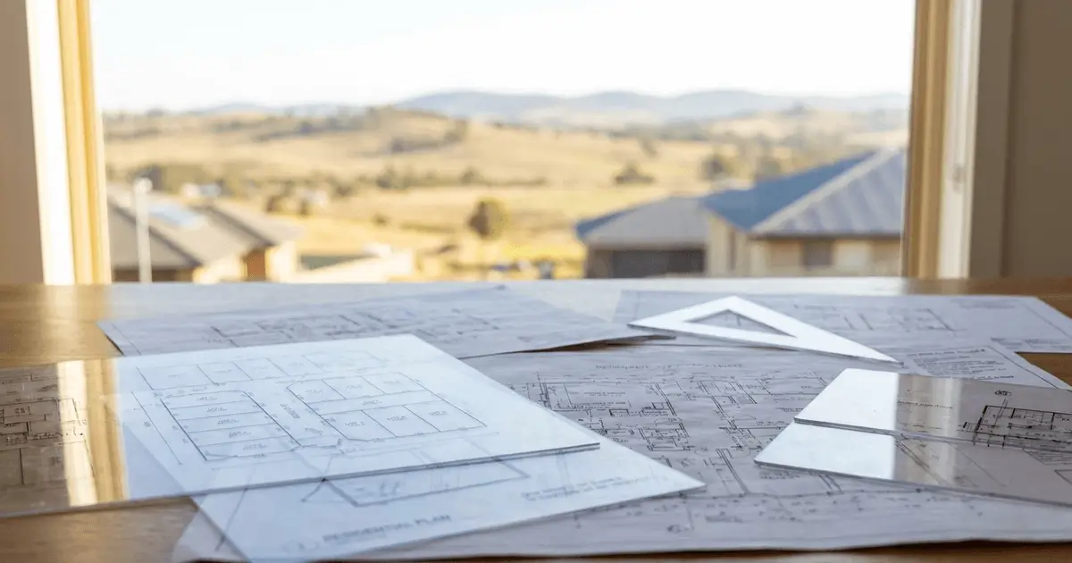
Under the Australian Constitution, land management, planning instruments, and urban development powers sit with state and territory governments rather than the Commonwealth.
There is no single national planning map for Australia.
A builder expanding across state borders cannot use a unified federal portal. Zoning in New South Wales means the NSW ePlanning Spatial Viewer; in South Australia it means SAPPA; Western Australia runs PlanWA; Victoria runs VicPlan; Queensland runs the Queensland Globe.
Each tool runs on separate GIS architecture, indexes different legislation, and uses incompatible zoning terminology. Here is the multi-state comparison, including direct URLs, underlying legal frameworks, and the terminology translations interstate operators need.
Key Takeaways
- State sovereignty over planning: Every state maintains its own spatial portal and cadastral database. Federal authorities do not publish private property zoning maps.
- The SIX Maps succession: NSW DCS Spatial Services retired the legacy SIX Maps platform in May 2025, replacing it with SDT Explorer. SDT Explorer is a spatial-data workbench, not a planning tool — zoning, overlays and Property Reports remain on the ePlanning Spatial Viewer.
- Unified vs fragmented: South Australia governs all land under a single statewide Planning and Design Code. NSW and Victoria still manage planning across dozens of independent municipal schemes.
- Terminology differs, and so does meaning: NSW uses numeric zones (R2, R3) plus FSR; WA layers R-Codes (R20, R40, R60) over scheme zoning; Victoria uses named bands (NRZ, GRZ, RGZ); SA and Queensland use different vocabularies again.
- Free everywhere, legal nowhere: All five jurisdictions produce a free automated output. None is a statutory certificate, and none may be relied on as contractual disclosure.
- The "espatial" legacy: PlanWA is still served from the
espatial.dplh.wa.gov.audomain, so searches for "espatial" and "PlanWA" reach the same tool.
National Comparison: Australian Planning Portals
| State | Flagship Spatial Map Viewer | Official Direct URL | Governing Statutory Framework | Free Property Report Feature | Foundation Cadastre Agency |
|---|---|---|---|---|---|
| New South Wales (NSW) | NSW Planning Portal Spatial Viewer | planningportal.nsw.gov.au/spatialviewer | Local Environmental Plans (LEPs) & SEPPs under the EP&A Act 1979 | Yes (Instant PDF Property Report) | NSW DCS Spatial Services (DCDB) |
| South Australia (SA) | SAPPA (SA Property & Planning Atlas) | sappa.plan.sa.gov.au | Single statewide Planning and Design Code under the PDI Act 2016 | Yes (Property data + direct P&D Code lookup) | Land Services SA / Surveyor-General |
| Western Australia (WA) | PlanWA (DPLH eSpatial) | espatial.dplh.wa.gov.au/planwa | Local & region schemes under the Planning and Development Act 2005, plus R-Codes | No (Run a Planning Enquiry; layer view & scheme link) | Landgate |
| Victoria (VIC) | VicPlan (Planning Victoria) | mapshare.vic.gov.au/vicplan | Victoria Planning Provisions (VPP) under the Planning and Environment Act 1987 | Yes (Planning Property Report) | Land Use Victoria (Vicmap) |
| Queensland (QLD) | Queensland Globe (state spatial data) | qldglobe.information.qld.gov.au | Council planning schemes & the State Planning Policy under the Planning Act 2016 | Partial (Cadastral SmartMap & property details; no planning report) | Department of Resources (DCDB) |
Two footnotes are essential for operational use.
Queensland's statutory mapping is not the Globe. Matters of state interest and development assessment triggers are mapped in the Development Assessment Mapping System (DAMS) and the State Planning Policy interactive mapping system (SPP IMS), both run by the Department of State Development, Infrastructure and Planning. Use the Globe for what is on this land; use DAMS for what triggers apply to this application.
Development.i is a council tool, not a state platform. It is Brisbane City Council's development application register, which replaced the older PD Online system and has been adopted by several other Queensland councils. It is excellent for reviewing what has been approved near a site, but it is not a source of statutory zoning.
State-by-State Deep Dive
1. New South Wales: NSW Planning Portal Spatial Viewer
- The Engine: NSW Department of Planning, Housing and Infrastructure (DPHI).
- Key Features: Standard Instrument zones (
R1–R5,E1–E5,C1–C4) plus statutory overlays for Floor Space Ratio, Height of Buildings, and bushfire/flood hazards. - The SIX Maps Update: SIX Maps was retired in May 2025. Its replacement, SDT Explorer (
portal.spatial.nsw.gov.au/explorer), is a spatial-data workbench — statutory planning layers and Property Reports remain on the ePlanning Spatial Viewer. - Detailed guide: ePlanning Spatial Viewer Guide.
2. South Australia: SAPPA (SA Property and Planning Atlas)
- The Engine: PlanSA and the Department for Housing and Urban Development (DHUD).
- The Advantage: Under the PDI Act 2016, SA replaced individual council schemes with a single statewide Planning and Design Code.
- Workflow: SAPPA maps zones and overlays against land administration boundaries, then links out to SAILIS for title data and into the P&D Code, so you move from parcel to operative rule in one workflow.
- Detailed guide: How to use SAPPA to check zoning in Adelaide.
3. Western Australia: PlanWA (DPLH eSpatial)
- The Engine: Department of Planning, Lands and Heritage (DPLH), in partnership with Landgate.
- The R-Codes System: Local schemes set the zoning; the Residential Design Codes (R-Codes) set density.
R20implies an average 450 m² per dwelling (~20 dwellings/ha);R60implies roughly 150 m² per dwelling. - Cadastral Base: PlanWA connects to Landgate's Shared Location Information Platform (SLIP) for property boundaries, Crown land reserves and pastoral leases.
4. Victoria: VicPlan
- The Engine: Department of Transport and Planning (Planning Victoria).
- The VPP Framework: The Victoria Planning Provisions are standardized across Victoria's 79 municipalities.
- Residential Zones:
NRZ(Neighbourhood Residential — character protection, garden area and height limits),GRZ(General Residential — townhouses and dual occupancies, typically up to 3 storeys),RGZ(Residential Growth — multi-storey around stations and activity centres). - Free Report: VicPlan generates the Planning Property Report covering LGA, zone and overlays.
5. Queensland: Queensland Globe, SPP IMS and DAMS
- The Engine: The Globe is maintained by the Department of Resources as a whole-of-government location platform; planning-specific statutory mapping sits with the Department of State Development, Infrastructure and Planning.
- The Model: The Globe is a high-capability geospatial viewer for resources, vegetation, tenure, cadastre and topography — the best of the five at answering what is on this land.
- The Statutory Layer: Assessment triggers live in DAMS and the SPP IMS, not the Globe. DAMS also identifies whether an application must be assessed or referred to the State Assessment and Referral Agency (SARA) under the Planning Regulation 2017.
- Council Portals: Planning is devolved under the Planning Act 2016; Brisbane City Council operates City Plan online and Development.i.
Residential Zoning Comparison Across States
Interstate developers moving between Sydney, Melbourne, Brisbane, Perth and Adelaide must translate local zoning dialects:
| Development Typology | NSW Standard | VIC VPP | WA R-Codes | SA P&D Code | QLD Common Term |
|---|---|---|---|---|---|
| Low Density (Single Homes) | R2 Low Density | NRZ Neighbourhood Res | R12.5 to R20 | Suburban Neighbourhood | Low Density Residential |
| Medium Density (Townhouses) | R3 Medium Density | GRZ General Res | R30 to R40 | Housing Diversity Neighbourhood | Low-Medium Density (LMR) |
| High Density (Apartments) | R4 High Density | RGZ Residential Growth | R60 to R100+ | Urban Neighbourhood | High Density Residential |
| Semi-Rural Lifestyle Blocks | R5 Large Lot | RLZ Rural Living | Special Rural | Rural Living Zone | Rural Residential |
The danger is not the zone names — it is the words around them. Victoria and NSW both use overlay, so practitioners moving between those two states are usually safe. Move to Queensland, where a precinct can sit inside a planning scheme carrying its own assessable outcomes, or to South Australia, where a subzone can materially change what the underlying zone permits, and equivalence fails. In SA, two parcels within the same Code zone can produce different development outcomes because of the subzone and overlay combination layered on top.
The implication for a national builder is that a site's zoning label is the least transportable fact about it. The zone name is an identifier; the permitted-use test, the assessment pathway and the constraint overlays are where the real answer lives.
Fast-Track Approval Pathways Compared
Each state operates a mechanism to bypass council DA backlogs for compliant residential builds:
- NSW: Complying Development Certificate (CDC) under the Codes SEPP — 20-day private certifier approval, subject to strict land-based exclusions (CDC Eligibility Guide).
- South Australia: Deemed-to-Satisfy (DTS) under the Planning and Design Code — a prescriptive checklist assessed by council or an accredited private planning professional.
- Victoria: VicSmart — a streamlined council assessment for minor subdivisions, small extensions and boundary adjustments.
- Western Australia: Deemed-to-Comply under the R-Codes Volume 1, letting compliant single dwellings proceed directly to a building permit.
Every one of these pathways is land-based-exclusion sensitive. Bushfire, flood, heritage, biodiversity and infrastructure overlays can each push a site into full merit assessment, regardless of state.
Free Reports vs Statutory Certificates: The Boundary You Must Not Cross
Every one of the five platforms produces something at no cost. Every one of those free outputs is an informational summary, and none can be relied on as contractual disclosure or as a legal answer. Each state's legally operative document is separately prescribed and fee-based:
| State | Free viewer output | Statutory instrument |
|---|---|---|
| NSW | Spatial Viewer Property Report (PDF) | Section 10.7 Planning Certificate (EP&A Act 1979) |
| VIC | Planning Property Report | Planning certificate under s 199 (Planning and Environment Act 1987) |
| QLD | Cadastral SmartMap / property details | Limited, standard or full Planning and Development Certificate (Planning Act 2016) |
| WA | Run a Planning Enquiry | No single statewide form — confirmation is generally sought from the relevant local government |
| SA | Property data + P&D Code lookup | Section 7 search under the Land and Business (Sale and Conveyancing) Act 1994 |
The sequence is always the same: use the free viewer to screen the site and shape your questions, obtain the statutory certificate before going unconditional, then plan on the certificate. A viewer that returns R2 tells you what to go and read; it does not tell you what you are entitled to build.
For the full treatment in New South Wales, see Spatial Viewer Property Report vs Section 10.7 Certificate.
Foundation Cadastres: The Digital Ground Truth
Planning overlays are meaningless without accurate underlying title boundaries. Every viewer projects planning layers on top of a foundational Digital Cadastral Database (DCDB): NSW DCS Spatial Services, Land Services SA and the Surveyor-General, Landgate in WA, Land Use Victoria (Vicmap), and the Queensland Department of Resources.
Because the cadastral layer and the statutory planning layer are maintained by different agencies on different update cycles, they periodically disagree. A newly registered subdivision may still return its parent parcel; rural zone boundaries digitised from simplified cadastral lines may show apparent slivers along fence lines with no legal meaning. Neither layer is wrong — they answer different questions on different clocks.
To understand why physical fences often deviate from cadastral lines, read our guide on what is a cadastral map.
Frequently Asked Questions (FAQ)
Is there a single federal planning map for all Australian properties?
No. Planning legislation and zoning powers are state constitutional responsibilities. Each state operates an independent viewer: NSW uses the ePlanning Spatial Viewer, South Australia uses SAPPA, Western Australia uses PlanWA, Victoria uses VicPlan, and Queensland uses the Queensland Globe.
What happened to SIX Maps in NSW, and what is the six maps replacement?
SIX Maps was the legacy spatial viewing platform operated by NSW DCS Spatial Services, retired in May 2025. Its replacement is SDT Explorer (Spatial Digital Twin Explorer), which focuses on statewide spatial data, survey information and 3D digital twin content. SDT Explorer is not a planning tool — for statutory planning instruments, zoning maps, built-form controls and Property Reports you must use the NSW Planning Portal Spatial Viewer.
Can I download a free property planning report in Victoria like in NSW?
Yes. Planning Victoria provides a free Planning Property Report through VicPlan at mapshare.vic.gov.au/vicplan. It details the local government area, zone, and planning overlays affecting the parcel, with localised zone and overlay maps attached. Like the NSW equivalent, it is informational and does not replace a statutory planning certificate.
What is "espatial", and is it different from PlanWA?
They are the same tool. Espatial is the legacy domain name of the WA Department of Planning, Lands and Heritage's spatial services, and PlanWA is still served from espatial.dplh.wa.gov.au/planwa.
Can I get a free planning report from PlanWA in Western Australia?
Not in the sense NSW and Victoria provide one. PlanWA returns a structured Run a Planning Enquiry against the schemes, structure plans and layout plans applying to a parcel, rather than a downloadable report. PlanWA notes the enquiry result comes from a pre-determined list and may change over time, so treat it as a screening tool. Western Australia also has no single statewide planning certificate.
How do Western Australia's R-Codes relate to land zoning?
Local planning schemes establish the zoning (Residential, Commercial and so on), while the Residential Design Codes (R-Codes) specify permissible density. A property coded R20 allows an average of 20 dwellings per hectare (450 m² average site area per dwelling); R40 permits medium-density development (around 220 m² average site area per dwelling). Transitional arrangements under R-Codes Volume 1 concluded on 10 April 2026, so confirm which version applies to your assessment date.
Is Development.i a Queensland state government planning tool?
No. Development.i is a development application register operated by Brisbane City Council, which replaced its PD Online system; several other Queensland councils have adopted it. It is useful for researching application history near a site, but statutory zoning comes from the relevant council planning scheme, and state-level assessment triggers come from DAMS.
What This Means for Interstate Feasibility Work
The five viewers give a national builder a fast, free and reliable way to locate a site, identify the instrument governing it, and spot the overlays that will shape cost and approval risk. They do not give a legal answer, and they do not translate cleanly across borders.
The workflow that avoids the most expensive mistakes is short: confirm the council before the address, search by Lot and Plan rather than street address, capture the instrument name alongside the zone code, read the statutory text for the permitted-use test, screen the overlays that change cost, and order the statutory certificate before going unconditional.